PropEco API · Free trial

Property & location intelligence. Fast, flexible and ready to use.

Access comprehensive property and location data, geospatial analysis and PropEco’s proprietary models through a single REST API.

Save time, reduce complexity and unlock valuable insights to enhance your products, services and decision-making.

✓ One access key, multiple endpoints✓ Property-level insights✓ Support from our team

Get started

Request your free API trial

Complete the form below to get started.

Why PropEco?

Turn property intelligence into business value.

Unlock the full potential of property and location intelligence to enhance your offerings, discover new opportunities and make smarter decisions.

Save time & reduce complexity

Streamline workflows, eliminate complex data wrangling and quickly access valuable property and location intelligence.

Enhance products & services

Enrich existing products, platforms and customer experiences with specialist property and location intelligence.

Make better decisions & reduce risk

Identify risks, assess opportunities and make more informed decisions using detailed, reliable insights.

Unlock new opportunities

Develop innovative solutions, strengthen customer relationships, stand out from competitors and create new value from property and location intelligence.

API endpoints

Seven purpose-built API endpoints.

Choose the endpoints that fit your application. Each provides specialist property, location or environmental intelligence, with dedicated technical documentation.
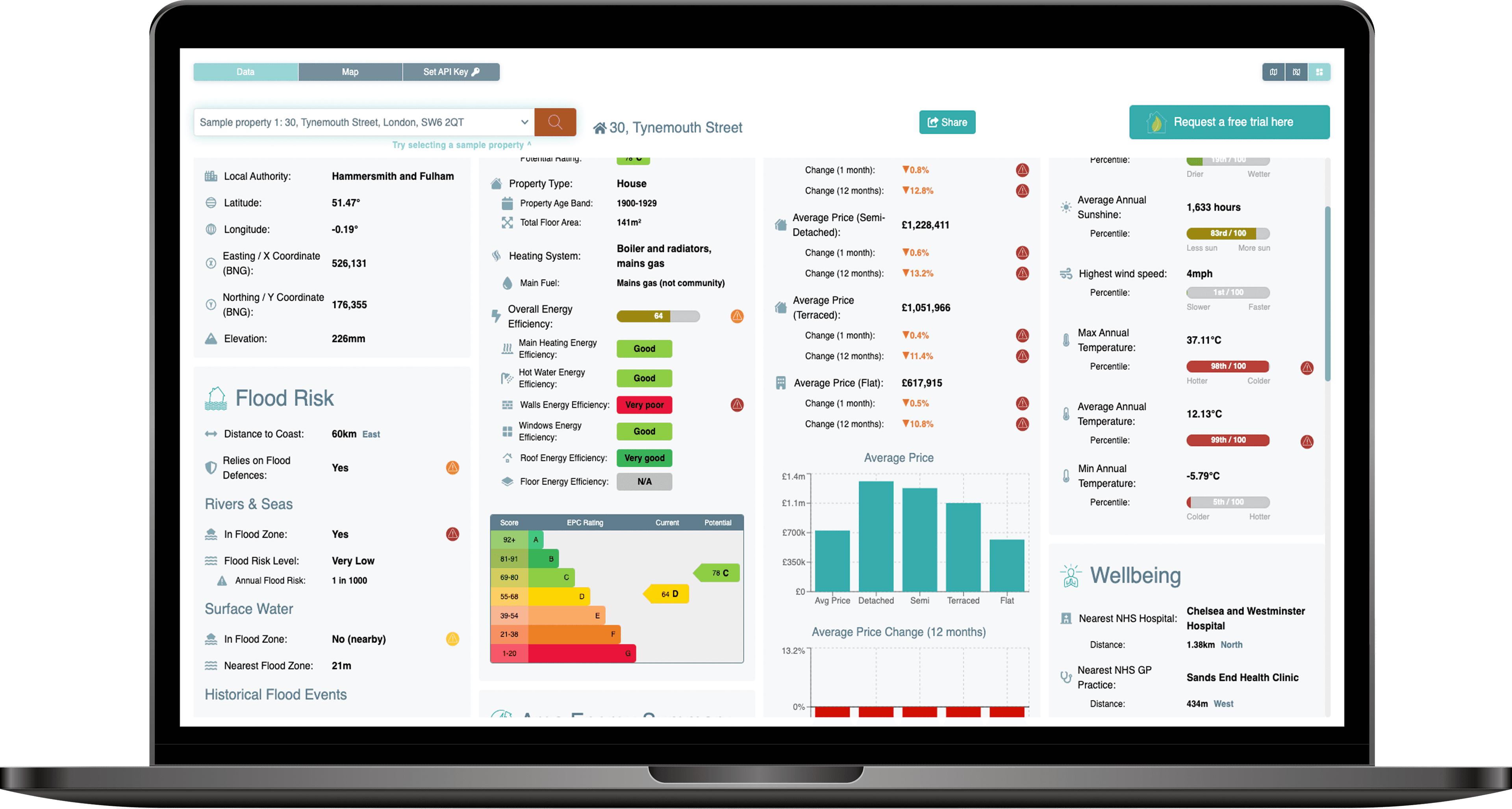
Example PropEco product screenshot 1

Data coverage

Explore the many dimensions of property and place.

PropEco combines property, location and environmental datasets with geospatial analysis, statistical processing and proprietary models. Search using just a coordinate or UPRN to access the following insights.

Property & energy

Property characteristics, energy efficiency, climate resilience and retrofit potential.

Property Attributes

Including building design, levels of insulation and glazing.

Energy Performance Certificates

Enhanced EPC data, estimates, benchmarking and statistics.

Solar Resources

Estimated viability, cost, yield and payback of installing solar panels.

Upgrade Options

Projected costs and benefits of viable green retrofit options.

Grants

Local and national support schemes for green home upgrades.

Climate & environmental risk

Current and future exposure to climate-related and natural hazards.

Flood Risk

Current and future risk of flooding from rivers, seas and surface water.

Historical Flooding

Proximity and location of recorded flood events.

Flood Defences

Reliance on flood defences.

Climate Change Projections

Projected changes to temperature and weather patterns under multiple climate change scenarios.

Coastal Erosion

Proximity and location of affected areas.

Coastal Inundation

Vulnerability to rising sea levels.

Overheating Risk

Exposure and resilience to extreme heat.

Subsidence

Current and future exposure to subsidence risk factors.

Wildfire Risk

Proximity and location of major wildfires.

Landslides

Proximity and location of recorded landslides.

Environment & wellbeing

Environmental characteristics that influence health, comfort and liveability.

Air Quality

Concentrations of common pollutants including particulate matter and sulphur dioxide.

Noise

Exposure to noise from roads, railways and airports.

Greenspace

Proximity of parks, nature reserves and other greenspaces.

Land use

Including nearby shading, greenspace and concrete cover.

Radon Exposure

An indicative assessment of radon exposure.

Landfill

Proximity and location of current and former landfill sites.

Proximity to water

Distance to rivers, lakes and seas.

Power Plants

Proximity and location of nearby renewable, nuclear and coal power plants.

Location & society

Local context, services and socioeconomic characteristics.

Location Details

Names and identifiers of relevant administrative boundaries and regions.

Social Factors

Including indices of deprivation and fuel poverty.

Crime

Up-to-date crime statistics.

House Prices

Average prices and price trends of residential properties.

Healthcare Facilities

Distance to and location of the closest hospitals, GP practices, dentists and defibrillators.

Connectivity

Broadband and mobile network coverage.

Transport & infrastructure

Nearby transport networks and infrastructure.

Transport Links

Distance to, location and details of the closest bus stops, train stations and airports.

Roads

Proximity and location of major roads.

EV Chargepoints

Proximity and location of electric vehicle charging infrastructure.

Low Emission Zones

An assessment of nearby low emission zones, existing and planned.

Planning & physical context

Planning constraints and characteristics of the surrounding location.

Planning Restrictions

Planning restrictions including conservation areas, listed buildings and World Heritage Sites.

Elevation

Height above sea level of the property or location.

Daylight

Day lengths and sun paths at a location or property.

Weather

Historical weather trends and rankings covering temperature, rainfall, wind speed and sunshine.

Developer-friendly

Integrate intelligence directly into your products.

Access a wide range of specialist property, location, climate and energy analysis through easy-to-integrate, purpose-built endpoints.

{ "uprn": 34076006, "location": { "uprn": 34076006, "x_coord": 526131, "y_coord": 176355, "latitude": 51.47211, "longitude": -0.1853445, "admin_boundaries": { "postcode": "SW6 2QT", "census_output_area_code": "E00009707", "county_code": "E13000001", "county_electoral_division_code": "E99999999", "local_authority_district_code": "E09000013", "electoral_area_code": "E05013747", "health_area_code": "E18000007", "country_code": "E92000001", "region_code": "E12000007", "parliamentary_constituency_code": "E14001160", "european_electoral_region_code": "E15000007", "travel_to_work_area_code": "E30000234", "itl_area_code": "E09000013", "national_park_code": "E65000001", "census_lower_layer_super_output_area_code": "E01035487", "census_middle_layer_super_output_area_code": "E02000394", "census_workplace_zone": "E33033988", "ccg_lhb_chp_area_code": "E38000256", "built_up_area_code": "E63012087", "census_rural_urban_classification": "UN1", "census_output_area_classification": "3c2", "local_enterprise_partnership_code": "E37000051", "local_enterprise_partnership_secondary_code": null, "police_force_area_code": "E23000001", "electoral_area_name": "Sands End", "local_authority_district_name": "Hammersmith and Fulham", "county_name": "Hammersmith and Fulham", "region_name": "London", "country_name": "England" }, "elevation": { "elevation_upper": 3.38, "elevation_lower": -1.74, "elevation_estimate": 1.4138392905671728, "distance_from_upper": 264.82580663159666, "distance_from_lower": 424.7964218305467, "azimuth_ascending_degrees": 109.46256560940512, "azimuth_descending_degrees": 56.639128942775336, "is_above_high_tide_line": false } }, "planning": { "conservation_areas": { "in_conservation_area": true, "conservation_area_area": 2232158.3556300737, "conservation_area_proportion": 0.7151041414312149, "nearest_conservation_area": { "name": "No data available for publication by HE", "distance": 0, "data_available": false, "nearest_point": null } }, "listed_buildings": { "nearest_listed_buildings": [ { "distance": 272.65926201169736, "x_coord": 525867.650000001, "y_coord": 176425.638875, "latitude": 51.472803363681365, "longitude": -0.1891093336308952, "name": "LANGFORD SCHOOL INCLUDING WALL, RAILINGS, GATES AND ENTRANCES, AND FORMER SCHOOL KEEPER'S HOUSE AND SPECIAL SCHOOL", "grade": "II", "date_listed": "2009-08-06T23:00:00.000Z", "url": "https://historicengland.org.uk/listing/the-list/list-entry/1393408" }, { "distance": 404.2988160209559, "x_coord": 526507.3075, "y_coord": 176502.818125004, "latitude": 51.473354479784355, "longitude": -0.17987667978798275, "name": "CREMORNE BRIDGE, WEST LONDON EXTENSION RAILWAY BRIDGE", "grade": "II*", "date_listed": "2008-11-26T00:00:00.000Z", "url": "https://historicengland.org.uk/listing/the-list/list-entry/1393006" }, { "distance": 459.0246555692252, "x_coord": 526003.950000001, "y_coord": 176796.091750003, "latitude": 51.47610236703256, "longitude": -0.187015978762473, "name": "FORMER LABORATORY AT THE IMPERIAL GAS WORKS", "grade": "II", "date_listed": "2007-06-06T23:00:00.000Z", "url": "https://historicengland.org.uk/listing/the-list/list-entry/1392024" }, { "distance": 475.47437878733615, "x_coord": 526020.825000001, "y_coord": 176817.533625003, "latitude": 51.47629131271065, "longitude": -0.18676548323922187, "name": "OFFICE BUILDING AT THE FORMER IMPERIAL GAS WORKS", "grade": "II", "date_listed": "2007-06-06T23:00:00.000Z", "url": "https://historicengland.org.uk/listing/the-list/list-entry/1392025" }, { "distance": 494.79545054752094, "x_coord": 526618.171500001, "y_coord": 176441.524375001, "latitude": 51.47277885538365, "longitude": -0.17830319242949452, "name": "Cremorne Bridge, West London Extension Railway Bridge, Battersea", "grade": "II*", "date_listed": "2008-11-26T00:00:00.000Z", "url": "https://historicengland.org.uk/listing/the-list/list-entry/1393005" }, { "distance": 495.9440400961927, "x_coord": 525992.145, "y_coord": 176831.109000001, "latitude": 51.47641969688287, "longitude": -0.1871734055456125, "name": "WAR MEMORIAL", "grade": "II", "date_listed": "2007-06-06T23:00:00.000Z", "url": "https://historicengland.org.uk/listing/the-list/list-entry/1392026" }, { "distance": 564.5638515564086, "x_coord": 526042.855809047, "y_coord": 176912.640515104, "latitude": 51.47714114501708, "longitude": -0.18641454604452504, "name": "Gasholder No 2, Fulham Gasworks", "grade": "II*", "date_listed": "1970-05-11T23:00:00.000Z", "url": "https://historicengland.org.uk/listing/the-list/list-entry/1261959" }, { "distance": 654.1070248826896, "x_coord": 526747, "y_coord": 176575.000000002, "latitude": 51.47394959321589, "longitude": -0.17640147952629298, "name": "OLD BATTERSEA HOUSE", "grade": "II*", "date_listed": "1954-06-27T23:00:00.000Z", "url": "https://historicengland.org.uk/listing/the-list/list-entry/1065500" }, { "distance": 693.9798267983115, "x_coord": 525549, "y_coord": 176733.000000004, "latitude": 51.47563638690696, "longitude": -0.19358588507184643, "name": "NOS 71 TO 77 INCLUDING IRON RAILINGS", "grade": "II", "date_listed": "1970-05-11T23:00:00.000Z", "url": "https://historicengland.org.uk/listing/the-list/list-entry/1192382" }, { "distance": 702.7560031786114, "x_coord": 526776.000000001, "y_coord": 176634.000000004, "latitude": 51.47447333832597, "longitude": -0.17596300838318335, "name": "ST MARY'S VICARAGE (INCLUDING RAILINGS AND GATES)", "grade": "II", "date_listed": "1954-06-27T23:00:00.000Z", "url": "https://historicengland.org.uk/listing/the-list/list-entry/1299844" } ] }, "world_heritage_sites": { "in_world_heritage_site": false, "world_heritage_site_area": 0, "world_heritage_site_proportion": 0, "nearest_world_heritage_site": { "name": "Palace of Westminster, Westminster Abbey and St. Margaret's Church", "inscription_date": "1987-01-01T00:00:00.000Z", "notes": "Core Area", "url": "https://historicengland.org.uk/listing/the-list/list-entry/1000095", "distance": 4821.2320112402185, "nearest_point": { "x_coord": 529916.025999069, "y_coord": 179341.277999882, "latitude": 51.49809161098811, "longitude": -0.12978059568154365 } } }, "national_parks": { "in_national_park": false, "national_park_area": 0, "national_park_proportion": 0, "nearest_national_park": { "code": "E26000010", "name": "South Downs", "distance": 52414.49214631459, "nearest_point": { "x_coord": 496678.7996, "y_coord": 132997.799000001, "latitude": 51.088152792361065, "longitude": -0.6209624707641703 } } } }, "environment": { "air_quality": { "benzene": { "percentile": 99.7940401092176, "value": 0.6817068 }, "no2": { "percentile": 99.90388538430152, "value": 20.37211 }, "nox": { "percentile": 99.89957003420896, "value": 30.03811 }, "pm2.5": { "percentile": 99.8356237470724, "value": 8.446545 }, "pm10": { "percentile": 96.75680552994667, "value": 14.2705 }, "so2": { "percentile": 98.54808084612246, "value": 2.842329 } }, "greenspace": { "greenspace_area": 249860.6888183187, "greenspace_proportion": 0.0800464774, "nearest_greenspace_point": { "distance": 64.43658122526742, "x_coord": 526192.63, "y_coord": 176336.19, "latitude": 51.471927175308295, "longitude": -0.1844645464039543, "function": "Public Park Or Garden", "name": null } }, "landslides": [], "radon": { "radon_class": 1, "radon_affected_area": false, "radon_exceeding_action_level_min_likelihood": 0, "radon_exceeding_action_level_max_likelihood": 0.01 }, "subsidence": { "collapsible_deposits": { "class": 1, "legend": "Low", "advisory": "Areas of localised significant rating" }, "compressible_ground": { "class": 1, "legend": "Low", "advisory": "Areas of localised significant rating." }, "landslides": { "class": 1, "legend": "Low", "advisory": "Areas of localised significant rating." }, "running_sand": { "class": 1, "legend": "Low", "advisory": null }, "shrink_swell": { "class": 3, "legend": "Significant", "advisory": "Areas of localised significant rating." }, "soluble_rocks": { "class": 1, "legend": "Low", "advisory": null }, "shrink_swell_2030_medium_emissions": { "class": "Possible", "legend": "It is possible that climate change will affect clay shrink-swell susceptibility and change the likelihood of ground movement, which causes subsidence." }, "shrink_swell_2050_medium_emissions": { "class": "Probable", "legend": "It is probable that climate change will affect clay shrink-swell susceptibility and change the likelihood of ground movement, which causes subsidence." }, "shrink_swell_2070_high_emissions": { "class": "Probable", "legend": "It is probable that climate change will affect clay shrink-swell susceptibility and change the likelihood of ground movement, which causes subsidence." }, "shrink_swell_2030_high_emissions": { "class": "Probable", "legend": "It is probable that climate change will affect clay shrink-swell susceptibility and change the likelihood of ground movement, which causes subsidence." }, "shrink_swell_2080_medium_emissions": { "class": "Probable", "legend": "It is probable that climate change will affect clay shrink-swell susceptibility and change the likelihood of ground movement, which causes subsidence." } } }, "transportation": { "nearest_airport": { "name": "London City Airport", "distance": 17145.32305869944, "azimuth_degrees": 76.4380036982832, "x_coord": 542798.2557996714, "y_coord": 180375.5331606008, "latitude": 51.50428, "longitude": 0.0561 }, "low_emission_zones": { "in_low_emission_zone": true, "low_emission_zone_area": 3121445.152257984, "low_emission_zone_proportion": 1, "nearest_low_emission_zone": { "name": "London_ULEZ", "url": "https://tfl.gov.uk/modes/driving/ultra-low-emission-zone", "distance": 0, "nearest_point": null } }, "ev_charging_points": { "nearest_charging_points": [ { "distance": 24.300398212285252, "x_coord": 526149.9207485385, "y_coord": 176370.27343384735, "latitude": 51.472243, "longitude": -0.185067, "name": "Tynemouth Street" }, { "distance": 24.933474857774584, "x_coord": 526121.7213066816, "y_coord": 176378.14261359192, "latitude": 51.47232, "longitude": -0.18547, "name": "Tynmouth Street" }, { "distance": 32.2742501894088, "x_coord": 526132.8208975578, "y_coord": 176322.782356649, "latitude": 51.47182, "longitude": -0.18533, "name": "Lindrop Street" }, { "distance": 57.53002049030387, "x_coord": 526074.6282859455, "y_coord": 176343.59510883188, "latitude": 51.47202, "longitude": -0.18616, "name": "Lindrop Road" }, { "distance": 74.386387679891, "x_coord": 526158.5241039438, "y_coord": 176424.11900597543, "latitude": 51.472725, "longitude": -0.184924, "name": "Elbe Street" }, { "distance": 78.57274521357323, "x_coord": 526076.4215237667, "y_coord": 176411.51444497233, "latitude": 51.47263, "longitude": -0.18611, "name": "Tynmouth Street" }, { "distance": 86.79300552321156, "x_coord": 526045.0100863599, "y_coord": 176366.67361626908, "latitude": 51.472234, "longitude": -0.186578, "name": "suby1100007179" }, { "distance": 88.85030848038176, "x_coord": 526114.0300682702, "y_coord": 176267.79436360375, "latitude": 51.47133, "longitude": -0.18562, "name": "Glenrosa Street" }, { "distance": 89.33838258294242, "x_coord": 526156.1746027804, "y_coord": 176269.28351075877, "latitude": 51.471334, "longitude": -0.185013, "name": "Townmead Road" }, { "distance": 93.43933046161796, "x_coord": 526148.5119337098, "y_coord": 176446.79263576196, "latitude": 51.472931, "longitude": -0.18506, "name": "Elbe Street" } ] } }, "flood_risk": null, "climate": { "historical": { "average_rainfall": { "percentile": 5, "value": 630.878136 }, "average_sunshine": { "percentile": 79, "value": 1627.568507 }, "average_temperature": { "percentile": 99, "value": 12.41175113 }, "highest_rainfall": { "percentile": 27, "value": 48.36213045 }, "maximum_temperature": { "percentile": 98, "value": 40.03483407 }, "highest_wind_speed": { "percentile": 1, "value": 4.461679503 }, "minimum_temperature": { "percentile": 3, "value": -5.336074282 } }, "future_projections": { "annual_hot_days": { "baseline_hot_days": 2.4, "upper_recent_hot_days": 8.6, "upper_recent_hot_days_change": 6.199999999999999, "upper_recent_hot_days_change_relative": 2.583333333333333, "lower_recent_hot_days": 4.6, "lower_recent_hot_days_change": 2.1999999999999997, "lower_recent_hot_days_change_relative": 0.9166666666666666, "upper_hot_days": 42.1, "upper_hot_days_change": 39.7, "upper_hot_days_change_relative": 16.541666666666668, "lower_hot_days": 7.6, "lower_hot_days_change": 5.2, "lower_hot_days_change_relative": 2.166666666666667 }, "maximum_temperature": { "baseline_maximum_temperature": 30.93, "upper_recent_maximum_temperature": 33.95, "upper_recent_maximum_temperature_change": 3.020000000000003, "upper_recent_maximum_temperature_change_relative": 0.09763983187843528, "lower_recent_maximum_temperature": 31.64, "lower_recent_maximum_temperature_change": 0.7100000000000009, "lower_recent_maximum_temperature_change_relative": 0.02295505981247982, "upper_maximum_temperature": 39.08, "upper_maximum_temperature_change": 8.15, "upper_maximum_temperature_change_relative": 0.2634982217911413, "lower_maximum_temperature": 31.88, "lower_maximum_temperature_change": 0.95, "lower_maximum_temperature_change_relative": 0.03071451665050113 }, "summer_precipitation": { "baseline_summer_precipitation": 1.53, "upper_recent_summer_precipitation": 1.67, "upper_recent_summer_precipitation_change": 0.1399999999999999, "upper_recent_summer_precipitation_change_relative": 0.09150326797385616, "lower_recent_summer_precipitation": 1.34, "lower_recent_summer_precipitation_change": -0.18999999999999995, "lower_recent_summer_precipitation_change_relative": -0.12418300653594767, "upper_summer_precipitation": 1.245267, "upper_summer_precipitation_change": -0.28473299999999996, "upper_summer_precipitation_change_relative": -0.1861, "lower_summer_precipitation": 1.320237, "lower_summer_precipitation_change": -0.20976300000000003, "lower_summer_precipitation_change_relative": -0.1371 }, "winter_precipitation": { "baseline_winter_precipitation": 1.65, "upper_recent_winter_precipitation": 1.97, "upper_recent_winter_precipitation_change": 0.32000000000000006, "upper_recent_winter_precipitation_change_relative": 0.193939393939394, "lower_recent_winter_precipitation": 1.64, "lower_recent_winter_precipitation_change": -0.010000000000000007, "lower_recent_winter_precipitation_change_relative": -0.006060606060606067, "upper_winter_precipitation": 2.080485, "upper_winter_precipitation_change": 0.4304849999999999, "upper_winter_precipitation_change_relative": 0.2609, "lower_winter_precipitation": 1.4754299999999998, "lower_winter_precipitation_change": -0.17457, "lower_winter_precipitation_change_relative": -0.1058 } } }, "social": { "house_price_index": { "date": "2026-01-08T00:00:00.000Z", "region_name": "Hammersmith and Fulham", "average_price": 754825, "average_price_seasonally_adjusted": null, "house_price_index": 89.4, "house_price_index_seasonally_adjusted": null, "percentage_change_1_month": 1.6, "percentage_change_12_months": -5.1, "sales_volume": null, "average_price_detached": 1763936, "house_price_index_detached": 92.4, "percentage_change_1_month_detached": 2, "percentage_change_12_months_detached": -0.8, "average_price_semi_detached": 1544924, "house_price_index_semi_detached": 94, "percentage_change_1_month_semi_detached": 2.1, "percentage_change_12_months_semi_detached": 0.9, "average_price_terraced": 1172812, "house_price_index_terraced": 94.2, "percentage_change_1_month_terraced": 2.2, "percentage_change_12_months_terraced": -2.2, "average_price_flat": 579711, "house_price_index_flat": 87.4, "percentage_change_1_month_flat": 1.4, "percentage_change_12_months_flat": -6.4, "average_price_cash": 751717, "house_price_index_cash": 89.3, "percentage_change_1_month_cash": 1.5, "percentage_change_12_months_cash": -5.2, "sales_volume_cash": null, "average_price_mortgage": 756219, "house_price_index_mortgage": 89.5, "percentage_change_1_month_mortgage": 1.7, "percentage_change_12_months_mortgage": -5, "sales_volume_mortgage": null, "average_price_first_time_buyer": 643534, "house_price_index_first_time_buyer": 88.5, "percentage_change_1_month_first_time_buyer": 1.6, "percentage_change_12_months_first_time_buyer": -5.5, "average_price_former_owner_occupier": 929765, "house_price_index_former_owner_occupier": 90.9, "percentage_change_1_month_former_owner_occupier": 1.7, "percentage_change_12_months_former_owner_occupier": -4.3, "average_price_new": null, "house_price_index_new": null, "percentage_change_1_month_new": null, "percentage_change_12_months_new": null, "sales_volume_new": null, "average_price_existing": null, "house_price_index_existing": null, "percentage_change_1_month_existing": null, "percentage_change_12_months_existing": null, "sales_volume_existing": null }, "fuel_poverty": { "lower_layer_super_output_area": { "lower_layer_super_output_area_code": "E01035487", "lower_layer_super_output_area_name": "Hammersmith and Fulham 023H", "household_count": 809, "fuel_poor_household_count": 60, "fuel_poor_household_percentage": 7 }, "local_authority": { "local_authority_district_code": "E09000013", "local_authority_district_name": "Hammersmith and Fulham", "household_count": 88809, "fuel_poor_household_count": 8657, "fuel_poor_household_percentage": 9.747885912463827 }, "region": { "region_code": "E12000007", "region_name": "London", "household_count": 3731959, "fuel_poor_household_count": 359488, "fuel_poor_household_percentage": 9.63268889074076 } }, "nhs_locations": { "nearest_hospital": { "distance": 1381.4277835797047, "azimuth_degrees": 16.935743411464543, "x_coord": 526355.3334399035, "y_coord": 177718.09105674824, "latitude": 51.48431015014648, "longitude": -0.1816297024488449, "name": "Chelsea and Westminster Hospital", "url": "http://www.chelwest.nhs.uk", "address1": "369 Fulham Road", "address2": null, "address3": null, "postcode": "SW10 9NH" }, "nearest_gp_practice": { "distance": 434.0683257660047, "azimuth_degrees": 279.592346553228, "x_coord": 525709.3269117592, "y_coord": 176457.99086409376, "latitude": 51.47312927246094, "longitude": -0.1913762241601944, "name": "Sands End Health Clinic", "url": null, "address1": "1 BROUGHTON ROAD APPROACH", "address2": null, "address3": null, "postcode": "SW6 2FE" }, "nearest_dentist": { "distance": 681.5908793608703, "azimuth_degrees": 301.55272328538643, "x_coord": 525633.340821908, "y_coord": 176820.7268183052, "latitude": 51.47640609741211, "longitude": -0.1923409402370453, "name": "New Kings Rd Dental Practice", "url": "http://www.newkingsroaddental.com/", "address1": "59 New Kings Road", "address2": "London", "address3": "London", "postcode": "SW6 4SE" } }, "defibrillators": [ { "distance": 235.07416912822993, "azimuth_degrees": 61.08598126721924, "x_coord": 526303.1706507438, "y_coord": 176515.0535285888, "latitude": 51.47351, "longitude": -0.18281, "location_name": "St George West London", "availability": "Varied Access", "access_type": "Restricted" }, { "distance": 245.9736845902887, "azimuth_degrees": 71.2084966660904, "x_coord": 526344.0110737708, "y_coord": 176478.00136569107, "latitude": 51.4731679, "longitude": -0.1822355, "location_name": null, "availability": "24/7 Access", "access_type": "Public" }, { "distance": 245.9736845902887, "azimuth_degrees": 71.2084966660904, "x_coord": 526344.0110737708, "y_coord": 176478.00136569107, "latitude": 51.4731679, "longitude": -0.1822355, "location_name": "Tesco Express", "availability": "Varied Access", "access_type": "Public" }, { "distance": 296.97392467090833, "azimuth_degrees": 162.66725601637975, "x_coord": 526195.0154642942, "y_coord": 176065.00770309236, "latitude": 51.4694895, "longitude": -0.1845269, "location_name": null, "availability": "Varied Access", "access_type": "Restricted" }, { "distance": 296.97392467090833, "azimuth_degrees": 162.66725601637975, "x_coord": 526195.0154642942, "y_coord": 176065.00770309236, "latitude": 51.4694895, "longitude": -0.1845269, "location_name": null, "availability": "Varied Access", "access_type": "Restricted" }, { "distance": 360.7357203233644, "azimuth_degrees": 332.1803354451811, "x_coord": 526009.6531294279, "y_coord": 176694.71340409148, "latitude": 51.47519, "longitude": -0.18697, "location_name": null, "availability": "Varied Access", "access_type": "Restricted" }, { "distance": 393.2161857435855, "azimuth_degrees": 269.89929251781257, "x_coord": 525737.9329731906, "y_coord": 176344.17035707302, "latitude": 51.4721, "longitude": -0.191005, "location_name": "L'ecole Des Petits", "availability": "Varied Access", "access_type": "Restricted" }, { "distance": 398.9406564306313, "azimuth_degrees": 348.2812573032834, "x_coord": 526069.9722823373, "y_coord": 176749.2451839021, "latitude": 51.47566666, "longitude": -0.186082495, "location_name": "Kings Road Park", "availability": "Varied Access", "access_type": "Public" }, { "distance": 412.61979435181905, "azimuth_degrees": 277.85397144271155, "x_coord": 525726.0143506106, "y_coord": 176434.0045472078, "latitude": 51.47291, "longitude": -0.1911446, "location_name": "Howdens At Fulham", "availability": "Varied Access", "access_type": "Restricted" }, { "distance": 415.3016841412404, "azimuth_degrees": 40.21386779514243, "x_coord": 526315.749994361, "y_coord": 176726.94479218562, "latitude": 51.47541148, "longitude": -0.182553342, "location_name": "The Design Studios - Chelsea Harbour", "availability": "24/7 Access", "access_type": "Public" } ], "indices_of_deprivation": { "lsoa_code": "E01035487", "lsoa_name": "Hammersmith and Fulham 023H", "local_authority_district_code": "E09000013", "local_authority_district_name": "Hammersmith and Fulham", "index_of_multiple_deprivation_score": 20.633, "index_of_multiple_deprivation_rank": 14227, "index_of_multiple_deprivation_decile": 5, "income_score": 0.297, "income_rank": 9684, "income_decile": 3, "employment_score": 0.133, "employment_rank": 13364, "employment_decile": 4, "education_skills_and_training_score": 9.443, "education_skills_and_training_rank": 23267, "education_skills_and_training_decile": 7, "health_deprivation_and_disability_score": 0.064, "health_deprivation_and_disability_rank": 15505, "health_deprivation_and_disability_decile": 5, "crime_score": -0.031, "crime_rank": 17238, "crime_decile": 6, "barriers_to_housing_and_services_score": 23.746, "barriers_to_housing_and_services_rank": 12324, "barriers_to_housing_and_services_decile": 4, "living_environment_score": 29.34, "living_environment_rank": 9629, "living_environment_decile": 3, "income_deprivation_affecting_children_score": 0.404, "income_deprivation_affecting_children_rank": 11804, "income_deprivation_affecting_children_decile": 4, "income_deprivation_affecting_older_people_score": 0.561, "income_deprivation_affecting_older_people_rank": 1571, "income_deprivation_affecting_older_people_decile": 1, "children_and_young_people_sub_domain_score": -0.359, "children_and_young_people_sub_domain_rank": 21941, "children_and_young_people_sub_domain_decile": 7, "adult_skills_sub_domain_score": 0.184, "adult_skills_sub_domain_rank": 22544, "adult_skills_sub_domain_decile": 7, "geographical_barriers_sub_domain_score": 10.132, "geographical_barriers_sub_domain_rank": 32590, "geographical_barriers_sub_domain_decile": 10, "wider_barriers_sub_domain_score": 3.849, "wider_barriers_sub_domain_rank": 4049, "wider_barriers_sub_domain_decile": 2, "indoors_sub_domain_score": -0.245, "indoors_sub_domain_rank": 20945, "indoors_sub_domain_decile": 7, "outdoors_sub_domain_score": 1.628, "outdoors_sub_domain_rank": 1014, "outdoors_sub_domain_decile": 1, "total_population_mid_2015_excluding_prisoners": 1576, "dependent_children_aged_0_15_mid_2015_excluding_prisoners": 235, "older_population_aged_60_and_over_mid_2015_excluding_prisoners": 266, "working_age_population_18_59_64_for_use_with_employment_depriva": 1141 } }, "energy": { "retrofit_grants": [ { "name": "Boiler Upgrade Scheme", "description": "Grant of up to £7,500 (£9,000 for some eligible off-gas properties) to cover part of the cost of replacing fossil fuel heating systems with a heat pump or biomass boiler.", "grant_value": 7500, "url": "https://www.gov.uk/apply-boiler-upgrade-scheme" } ], "average_energy_usage_stats": { "middle_layer_super_output_area": { "middle_layer_super_output_area_code": "E02000394", "electricity_meter_count": 6608, "mean_electricity_usage": 3796.8767, "mean_electricity_cost": 1199.46744744, "median_electricity_usage": 2628.25, "median_electricity_cost": 891.8849, "gas_meter_count": 2360, "mean_gas_usage": 10129.2705, "mean_gas_cost": 915.63485885, "median_gas_usage": 8211.192, "median_gas_cost": 762.7640023999999 }, "lower_layer_super_output_area": { "lower_layer_super_output_area_code": "E01035487", "electricity_meter_count": 904, "mean_electricity_usage": 2816.2676, "mean_electricity_cost": 941.37113232, "median_electricity_usage": 2086.15, "median_electricity_cost": 749.2041800000001, "gas_meter_count": 612, "mean_gas_usage": 8822.37, "mean_gas_cost": 811.474889, "median_gas_usage": 7172.616, "median_gas_cost": 679.9894952 } }, "epcs": { "epc_country": "England", "epc_in_date": true, "epc_age": 271004370872, "epc_expiry": "2028-04-12T23:00:00.000Z", "epc": { "address": "30, Tynemouth Street", "address1": "30, Tynemouth Street", "address2": null, "address3": null, "adjusted_costs": { "heating_cost_current": 1299.6, "heating_cost_potential": 1013.5, "hot_water_cost_current": 221.3, "hot_water_cost_potential": 136, "lighting_cost_current": 137.1, "lighting_cost_potential": 137.1, "total_fuel_cost_current": 1658, "total_fuel_cost_potential": 1286.6, "standing_charges": 305 }, "built_form": "Mid-Terrace", "certificate_number": "8788-7424-5370-3747-2996", "co2_emissions_current": 4.9, "co2_emissions_per_floor_area_m2_current": 35, "co2_emissions_potential": 2.7, "co2_emissions_reduction_potential": 2.2, "constituency": "E14001160", "constituency_label": "Chelsea and Fulham", "construction_age_band": "1900-1929", "country": "England", "dwelling_type": "Existing dwellings", "energy_consumption_per_floor_area_m2_current": 197, "energy_consumption_per_floor_area_m2_potential": 107, "energy_efficiency_current": 64, "energy_efficiency_potential": 78, "energy_rating_current": "D", "energy_rating_potential": "C", "energy_tariff": "Single", "environmental_impact_current": 55, "environmental_impact_potential": 72, "extension_count": 1, "fixed_lighting_outlet_count": 23, "flat_storey_count": 2, "floor_description": "Suspended, no insulation (assumed)", "floor_energy_efficiency": "N/A", "floor_environmental_efficiency": "N/A", "floor_height": 2.62, "floor_level": null, "floor_thermal_transmittance": null, "floor_type": "suspended", "glazed_area": "Normal", "glazed_type": "Double", "habitable_room_count": 6, "has_mains_gas": true, "has_solar_water_heating": false, "heat_loss_corridor": null, "heat_pump": false, "heated_room_count": 6, "heating_cost_current": 822, "heating_cost_potential": 641, "hot_water_cost_current": 140, "hot_water_cost_potential": 86, "hot_water_description": "From main system", "hot_water_energy_efficiency": "Good", "hot_water_environmental_efficiency": "Good", "inspection_date": "2018-04-12T23:00:00.000Z", "is_flat_top_storey": false, "lighting_cost_current": 85, "lighting_cost_potential": 85, "lighting_description": "Low energy lighting in 96% of fixed outlets", "lighting_energy_efficiency": "Very Good", "lighting_environmental_efficiency": "Very Good", "local_authority": "E09000013", "local_authority_label": "Hammersmith and Fulham", "lodgement_date": "2018-04-12T23:00:00.000Z", "lodgement_datetime": "2018-04-13T16:05:00.000Z", "low_energy_fixed_light_count": 22, "low_energy_lighting_percentage": 96, "main_fuel": "Mains gas (not community)", "main_heating_controls": "Programmer, room thermostat and TRVs", "main_heating_controls_description": "Programmer, room thermostat and TRVs", "main_heating_controls_energy_efficiency": "Good", "main_heating_controls_environmental_efficiency": "Good", "main_heating_description": "Boiler and radiators, mains gas", "main_heating_energy_efficiency": "Good", "main_heating_environmental_efficiency": "Good", "mechanical_ventilation": "Natural", "multi_glaze_percentage": 100, "open_fireplace_count": 2, "post_town": "London", "postcode": "SW6 2QT", "property_type": "House", "region": "E12000007", "report_type": "Reduced Standard Assessment Procedure (RdSAP)", "roof_description": "Pitched, 300 mm loft insulation", "roof_energy_efficiency": "Very Good", "roof_environmental_efficiency": "Very Good", "roof_photovoltaic_supply": 0, "roof_thermal_transmittance": null, "roof_type": "pitched", "second_heating_description": "Room heaters, mains gas", "second_heating_energy_efficiency": "N/A", "second_heating_environmental_efficiency": "N/A", "tenure": "Owner-Occupied", "total_energy_consumption_current": 27777, "total_energy_consumption_potential": 15087, "total_floor_area": 141, "transaction_type": "Marketed sale", "unheated_corridor_length": null, "uprn": 34076006, "uprn_source": "Energy Assessor", "walls_description": "Solid brick, as built, no insulation (assumed)", "walls_energy_efficiency": "Very Poor", "walls_environmental_efficiency": "Very Poor", "walls_thermal_transmittance": null, "walls_type": "solid", "wind_turbine_count": 0, "windows_description": "Fully Double Glazed", "windows_energy_efficiency": "Good", "windows_environmental_efficiency": "Good" } } } }

Property Data API · Sample request and response

Who it's for

Property intelligence for your workflows.

Mortgage lenders

Enrich lending decisions, underwriting and portfolio monitoring with property, energy and climate risk intelligence.

Learn more

Insurers

Integrate property hazards and location data into underwriting, pricing and exposure management workflows.

Learn more

Housing associations

Support asset management, retrofit prioritisation and climate resilience planning across your housing stock.

Learn more

Surveyors

Bring property, energy and environmental insights into valuation, inspection and reporting workflows.

Learn more

Domestic retrofit providers

Streamline assessments, identify improvement opportunities and support tailored retrofit recommendations.

Learn more

PropTechs & property platforms

Embed property and location intelligence into digital products, customer journeys and applications.

How it works

A simple route to trial access.

1

Send your request

Share your name, work email and company details.

2

We set up your access

Our team assesses your request and emails you an API access key.

3

Start exploring

Start using any of the API endpoints with a single access key.

FAQs

A few things you might want to know.

Is the API trial free?+

Yes! There is no cost involved. If you want to continue using the API beyond the trial, we can help you set up a PropEco subscription from as little as £29 + VAT per month.

Will I get access immediately?+

Not quite. We review trial requests individually but will follow-up as quickly as possible.

Do I need to create an account now?+

No. Just submit the short request form. We'll follow-up with access details.

Can I discuss a specific use case?+

Absolutely. You can tell us more about your requirements when we follow up on your request. Alternatively, contact us at info@propeco.io.

Ready to explore the PropEco API?

Submit your request to set-up access today.